Outdoor enthusiasts like us often associate the Blue Ridge Parkway with scenic drives. After all, the Parkway was constructed as a touring motor route linking Virginia’s Shenandoah National Park with Great Smoky Mountains National Park down in North Carolina and Tennessee. However, the parkway also has a wealth of trails coursing through mountainland that you can access while driving over scenic hill and dale.
Why not stop and stretch your legs on a path? Hikes of all lengths can be made from the Virginia section of the Parkway -- simple short jaunts to rewarding views, easy day hikes to work off that lunch or longer treks that reveal another, wilder side of the Parkway.
And hiking is a time-honored favorite of Parkway explorers. What do you seek in a day hike? Do you like to find wildflowers and identify nature’s plants and animals? Do you want to hike to a lesser-visited overlook? Do you want walks to a crashing waterfall? Do you want to learn about Virginia’s mountain heritage while trekking along a trail? How about a trip to the back of beyond?
Check out the following hikes on Virginia’s Blue Ridge Parkway and find your trailside adventure. The recommended hikes are listed by length, then each list heads from north to south down the Parkway in Virginia.
Short & Easy Leg Stretchers
Mountain Farm Trail
Location: Milepost 5.9
Length: .5 miles
Take advantage of starting this easy, level hike starting at the Humpback Rocks Visitor Center. Inside the visitor center, absorb interpretive information about mountain farms as well as area history. Shop, get maps, water and use the restroom; picnic too. Walk the appropriately named Mountain Farm Trail to visit the site of the William J. Carter Farm. Although no structures remain from Mr. Carter's farm, the on-site log structures are authentic. The William J. Carter Farm is designed to replicate an 1890s farmstead, so the buildings reflect that time.
Wigwam Falls
Location: Milepost 34.4
Length: .4 miles
Wigwam Falls tumbles 30-feet in stages. To reach Wigwam Falls, follow the easy and short Yankee Horse Trail. The waterfall is not actually on Wigwam Creek, but on a small tributary. Learn about the logging in the area while visiting the fall, viewing a 200-foot reconstructed track of an old railroad. This narrow-gauge line was part of the Irish Creek Railway, built by the South River Lumber Company to access trees that were untouched until the early 1900s. The area was logged out by the late 1930s. The name given the trail—Yankee Horse— got its name as a Union soldier’s horse fell here and had to be shot. Nearby Wigwam Mountain is said to be an ancient Indian hunting ground.
James River Self-Guiding Trail
Location: Milepost 63.6
Length: .4 miles
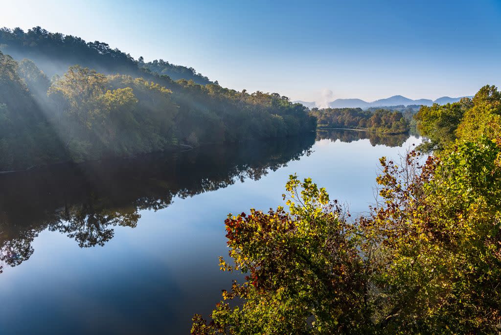
photo credit: Kristina Love, @kristinalovephotography
Start your little walk at the James River Visitor Center by the river and make a historic leap into the past. First, take an unusual hiker bridge that travels beneath the Parkway yet above the James River. Gaze into the river from the bridge. Cross the waterway then come to an old lock and canal area. Interpretive information gives life to the spot where goods and people were once transported up and down the James. The path ends at a riverside overlook. Backtrack to the visitor center.
Abbott Lake Loop
Location: Milepost 85.8
Length: 1.0 miles
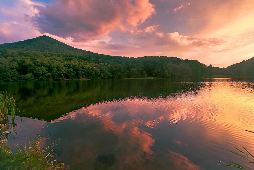
Photo credit: Monique Sombati, @thesombati6
This level trek starts at Peaks of Otter Lodge. Head out on the Lake Trail, now circling Abbott Lake, named for the Blue Ridge Parkway’s chief architect. Flat Top and Sharp Top rise in the distance. Take the spur left to Polly Woods Ordinary, a replica of a rural boardinghouse here long ago. Cross Abbott Lake Dam then curve past Peaks of Otter Campground. Ahead, another spur leads right to a fishing pier with a stellar view. Continue following the shoreline through woods and grasses, returning to the lodge.
Mountain Industry Trail
Location: Milepost 176.2
Length: .4 miles
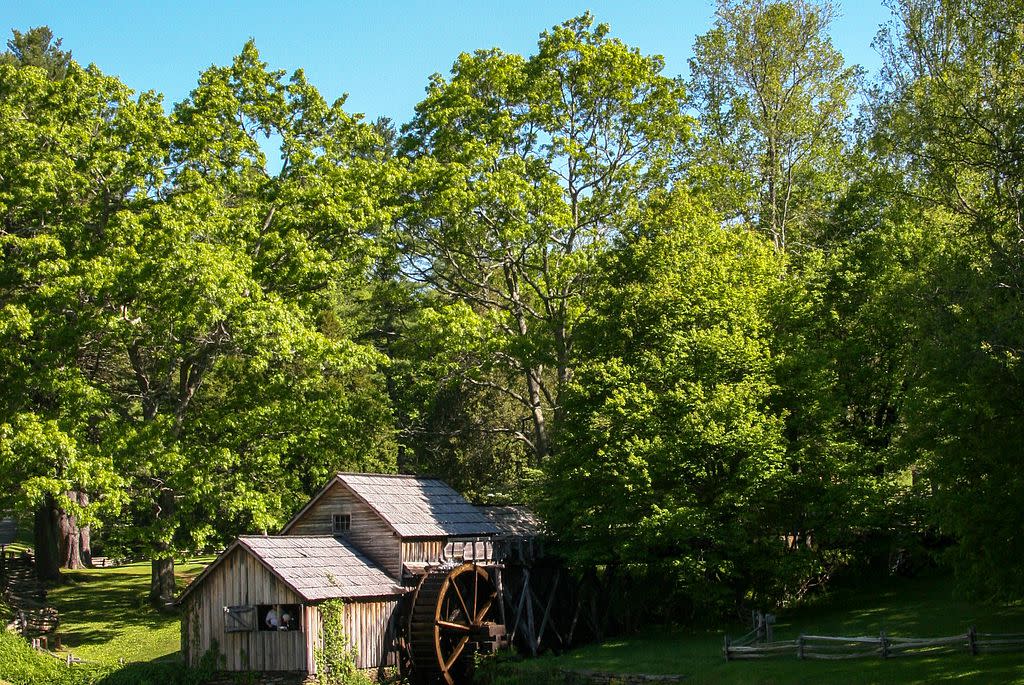
Take your time on this easy walk at popular Mabry Mill, a historical area. Enjoy interpretive information as you start at a dammed pond at the mill. See the mill, the mill flume, a pioneer cabin, and even a whisky still and molasses making display. Other elements of the old time industrial tour include a blacksmith shop. This well-liked spot includes seasonal living history displays that draw crowds. Top it off with a meal at the Mabry Mill country restaurant.
1-3 Mile Hikes
White Rock Falls
Location: Milepost 20.0
Length: 2.0 miles
The hardest part of this doubly rewarding hike is finding the correct trailhead. Park at The Slacks Overlook. Find the singletrack White Rock Falls Trail across the Parkway and just a little south from The Slacks Overlook. Begin descending a tributary of White Rock Creek in classic hickory oak woods. Bridge a creek, then reach a rewarding overlook at .5 mile. Gaze down into the Tye River Valley. White Rock Falls is below you, but stay with the maintained trail along a cliffline, then switchback to reach the spur to White Rock Falls at .9 mile. Take the spur then find the 30-foot slender spiller frothing into a rock-walled amphitheater complete with a dunking pool. A charming spot and a rewarding sight. Backtrack to the trailhead.
Otter Creek and Otter Lake Loop
Location: Milepost 63.6
Length: 3.0 miles
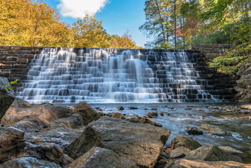
Photo credit: Kristina Love @kristinalovephotography
This worth-it walk starts at the James River Visitor Center, so take advantage and check out the interpretive displays before joining the Otter Creek Trail. Follow the waterway upstream, passing alluring pools that tempt a dip. Trace an old railroad bed then come to the 1-mile loop around Otter Creek Lake. Circle around the impoundment, where birds and beavers may be seen. Grab a view from a hilltop, then discover a former homesite. Meet the Otter Creek Trail, head back toward the visitor center, leaving the lake. Backtrack past the pools and shoals of Otter Creek before returning to the visitor center.
Fallingwater Cascades
Location: Milepost 83.5
Length: 1.5 miles
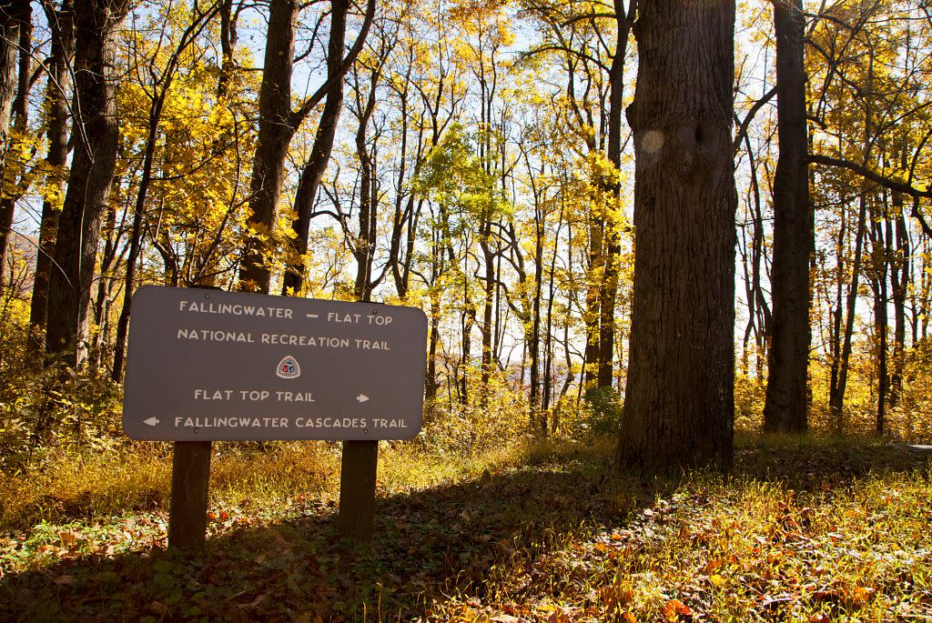
This loop delivers scenes of Fallingwater Cascades from multiple vantages. You see it from below at a distance, from its base, beside the cataract, and from above it. These multiple vantages provide an added appreciation of the 100-plus foot sloping slipping stream, and allow you to see the entirety of Fallingwater Cascades. Hike downhill into the rugged canyon of Fallingwater Creek, on the Fallingwater Cascades Trail, where boulders and woods lend a rugged aspect. Climb out of the geologically rich canyon, soaking in views of mountains down the creek valley before returning to the trailhead. Pass an additional auto overlook on the way.
Explore Park
Location: Milepost 115.0
Length: 3.0 miles
photo credit: Shannon Terry
This trail network is near the Roanoke River visitor center, just off the Parkway. From milepost 115, join Roanoke River Parkway. Follow it 1.5 miles to the visitor center. Turn left just beyond the visitor center and go .4 mile to parking lot D at Journey’s End. This hike travels the hiker-only trails coursing through Explore Park. First, walk along a scenic portion of the Roanoke River with rocky rapids, pools and beaches, then head for the hills, where you will wander through upland woods to find an intriguing assemblage of historic buildings reflecting Virginia’s past, including a schoolhouse, gristmill, cabin and a farmstead. From there it is a short walk back to the trailhead.
Smart View Loop
Location: Milepost 154.5
Length: 3.o miles
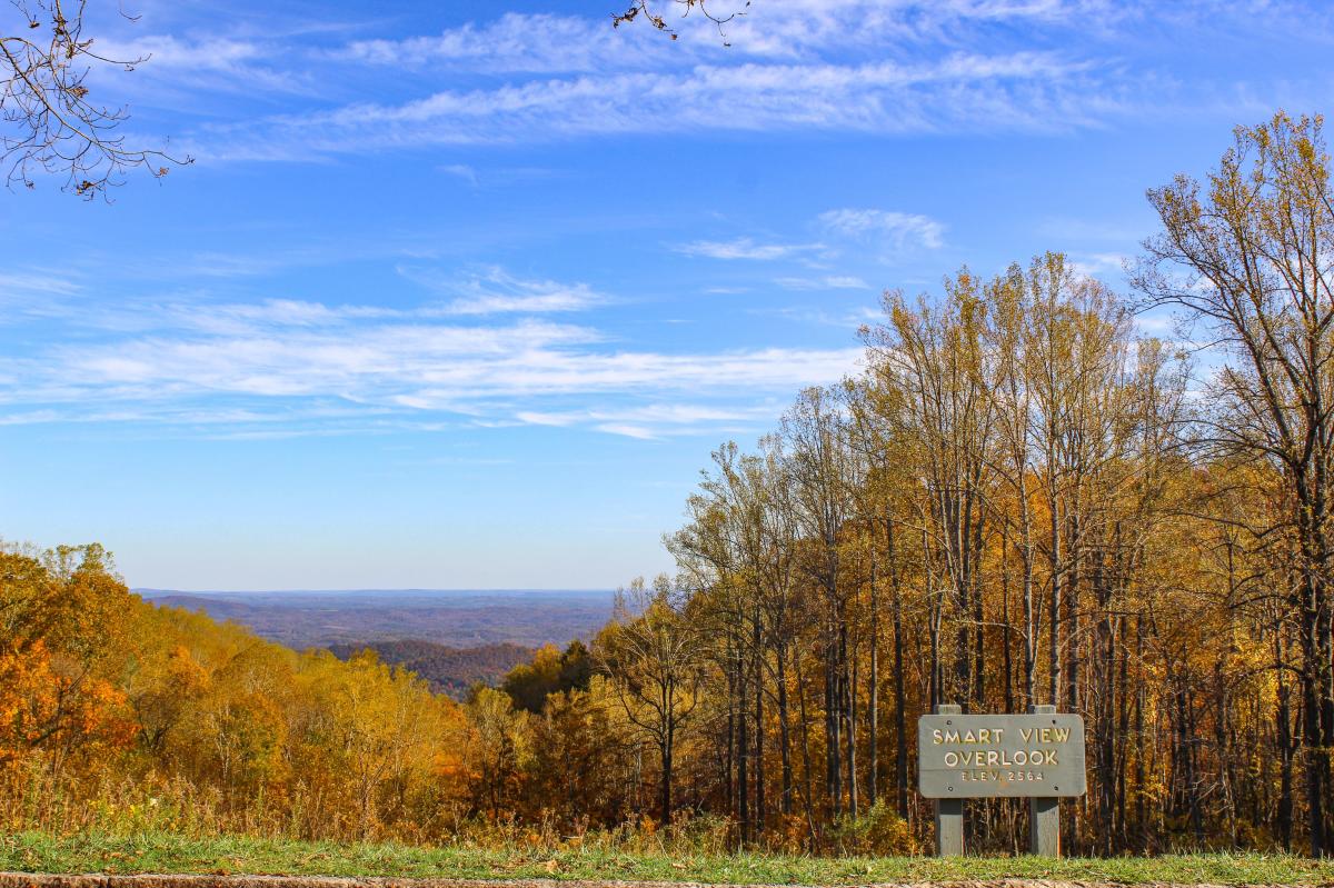
photo credit: Shannon Terry
This moderate loop hike offers ample rewards, with elevation changes just over a couple of hundred feet. Start at the Smart View Picnic Area and soak in human history at the Trail Cabin. It was one of the first structures targeted for preservation along the fledgling Blue Ridge Parkway. Examine the hand-hewn log cabin built by W.J. Trail in the 1880s. The cabin has almost no windows. The chinking in between the logs is now missing. Note the sizable stone chimney, built to render a roaring fire, warding off the chill of mountaintop winter nights in the Appalachians. Down trail, hikers on the well-marked and maintained trail network will circle through woods then come to a “Smart View” of the Piedmont in the distance before completing the circuit.
3-6 Mile Hikes
Humpback Rocks Loop
Location: Milepost 6.0
Length: 4.2 miles
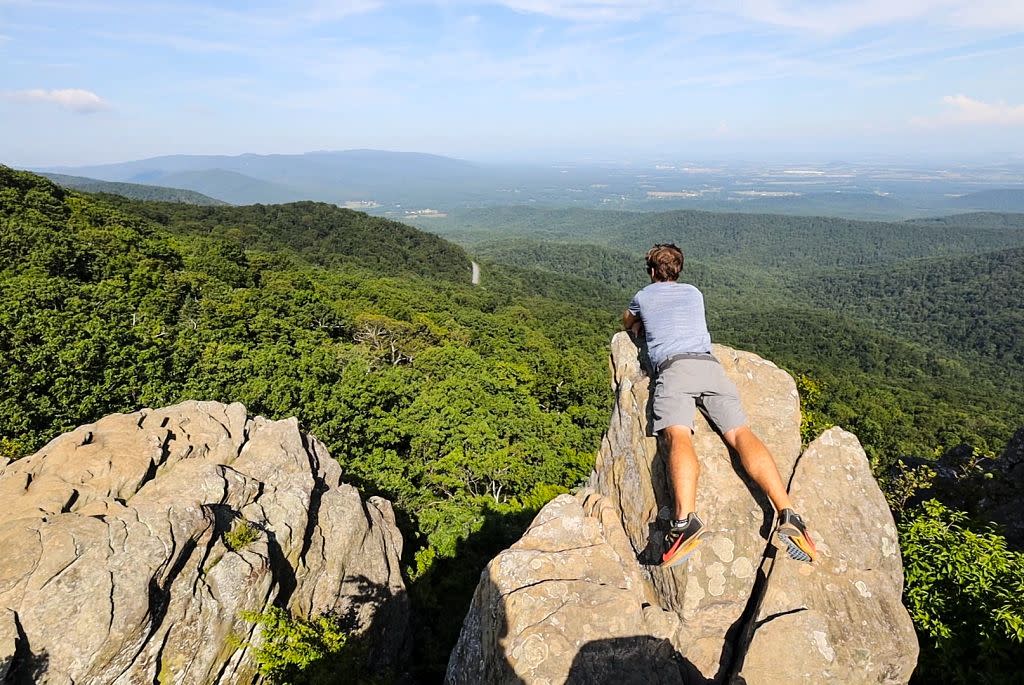
photo credit: Chad Williams, @echadwilliams
From Humpback Gap, climb the old Appalachian Trail up to the Humpback Rocks, a landmark wagon drivers used to note their progress. The ascent is challenging but the vista from this massive outcrop is more than worth it. To the west, the Blue Ridge drops off to the Shenandoah Valley, backed by hazy mountains marking the West Virginia border. The Piedmont falls to the east. Join the current Appalachian Trail, descending via switchbacks, then hop onto historic Howardsville Turnpike, returning to Humpback Gap.
Bluff Mountain
Location: Milepost 51.5
Length: 3.8 miles
This Parkway hike takes the famed Appalachian Trail to Bluff Mountain, a somber yet worthy destination. Here lies a memorial to Ottie Powell, a local lad lost in the woods a century back. His body was found here, astride the very peak of Bluff Mountain. The story of his disappearance has become legend. Leave the Parkway, hike the Appalachian Trail, visiting the purportedly haunted Punchbowl shelter. Walk on up to Bluff Mountain to see the wonderful panoramas of the adjacent Blue Ridge and the memorial to Ottie Powell.
Apple Orchard Falls Loop
Location: Milepost 78.4
Length: 5.1 miles
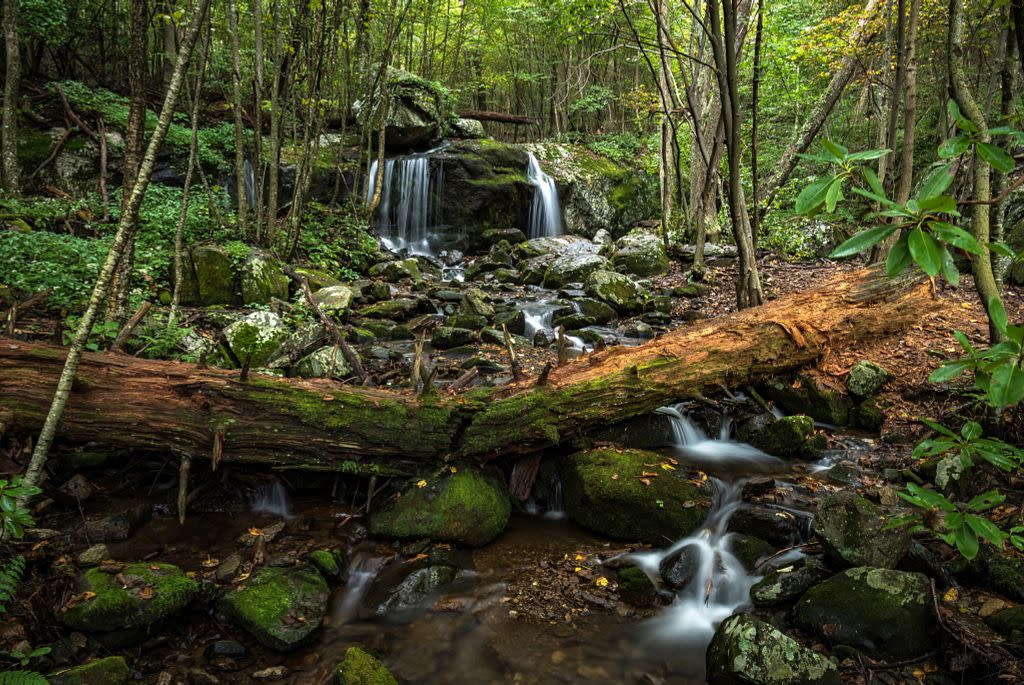
Photo credit: Kristina Love @kristinalovephotography
Your starting point, Sunset Fields Overlook, provides a western vista from atop lofty Apple Orchard Mountain, so named for the rounded off weathered oaks that grow atop it, resembling ranks of apple trees. Nevertheless, the Appalachian Trail is calling, and so is high Apple Orchard Falls, tumbling in its wide-ranging fashions, a menagerie of cascades in one location. After visiting 200-foot Apple Orchard Falls, backtrack a bit then make a loop via the Cornelius Creek Trail to meet the Appalachian Trail. A high country ramble on the AT along the slope of Apple Orchard Mountain leads you back to the parkway.
Flat Top
Location: Milepost 83.5
Length: 5.6 miles
If you can, choose a clear crisp day to make this hike. The views are spectacular. A bright fall day will reveal a kaleidoscope of color, while winter’s bite will redden your nose and hands but allow views to stretch to distant horizons. A spring day will picture spring greens inexorably climbing from the James River, 3,000 feet below. The switchback-laden climb on the Flat Top Trail takes you to the top of Flat Top Mountain, where views of the adjacent Peaks of Otter and beyond can be had from both sides of the mountain. Along the way, come across Cross Rock and a warm-up vista. The 1,500-foot climb to the top of Flat Top is mitigated by first-rate, quality trail construction and the aforementioned switchbacks.
Johnson Farm via Harkening Hill
Location: Milepost 85.9
Length: 3.6 miles
First, the Harkening Hill Trail takes you atop a geologically entrancing hillock with partial views and Balance Rock, then on to historic Johnson Farm, a preserved home replicating local life in the 1930s. Leave the Peaks of Otter visitor center on Harkening Hill Trail, summiting Harkening Hill. Ahead, visit surprising Balance Rock, a flat boulder precariously perched on a stone pedestal. Join the Johnson Farm Trail, reaching a site occupied since the late 1750s. The park service restored the farmhouse’s look – including furnishings -- to the 1930s era. The house is open for tours during the warm season. Pass through fields then come to the Hotel Mons site on your right, a relic from earlier tourist days. Return to the visitor center.
Hikes Longer Than 6 Miles
St. Marys Falls
Location: Milepost 23.0
Length: 10 miles
Mix waterfalls, wilderness and history in one scenic trek – with backpacking possibilities – at Saint Marys Wilderness. The out-and-back adventure leaves the Blue Ridge Parkway from the Mine Bank Trailhead on the parkway’s north side, just before reaching the more easily identifiable Fork Mountain Overlook, which will be on the Parkway’s south side. Find long sliding waterfalls from the Mine Bank Trail. Once along the Saint Marys River, head downstream to find ore processing remains and good camping. Along the way, view more ore processing relics as well as attractive falls and cool deep pools along Sugartree Branch and Saint Marys River, culminating in the trip to St. Marys Falls.
Rock Castle Gorge Loop
Location: Milepost 169.1
Length: 10.7 miles
This long and challenging loop has it all – widespread panoramas, human history, waterfalls, wildflowers, geological wonders – and trail challenges galore. Make a circuit over highland meadows, down the gorge of Rock Castle Creek, then up a steep track, past pioneer homesites, to the crest of the Blue Ridge and Rocky Knob, where more highland vistas put an exclamation point on this both rewarding and demanding federally designated national recreation trail. The circuit can be done as a long day hike. However, be apprised a primitive campsite is situated about halfway along the trek. A permit, available at the nearby Rocky Knob visitor center is required.